Just as Colonial Williamsburg tells the story of American Independence, so might a restored Tenth Street Freedman's Town bring the story of African American Independence to life.
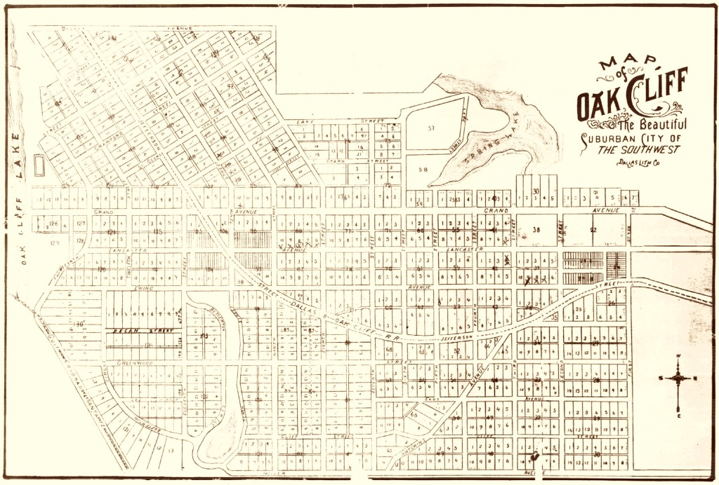
Original Oak Cliff
Original Oak Cliff, 1890. The map captures Oak Cliff in the year of her incorporation as a city, a moment of great optimism for the three year old venture. These are the blocks and lots of Original Oak Cliff. Areas lying outside of these bounds that are now considered part of Oak Cliff (the entirety of Bishop Arts, for example) are additions. The western boundary (top of this map) is Beckley Avenue. The eastern boundary is Miller Avenue (now Denley Drive), which follows the western edge of the 1846 Oak Cliff Cemetery. The northernmost street is First Street (now Brazos). The northeast corner (lower right on this map) lies in what is now called The Bottom.