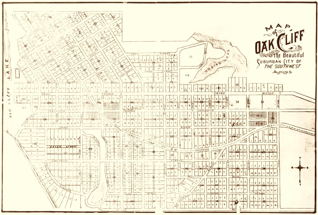
Original Oak Cliff
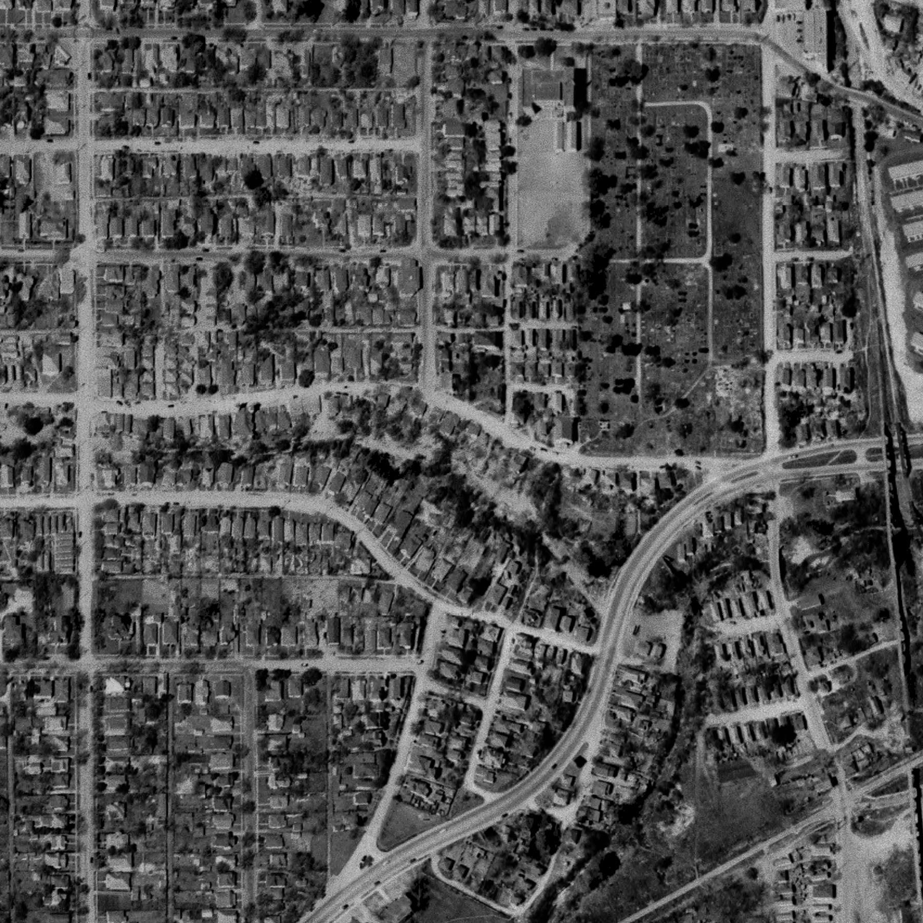
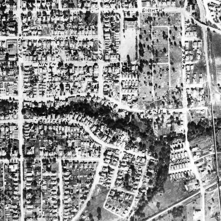
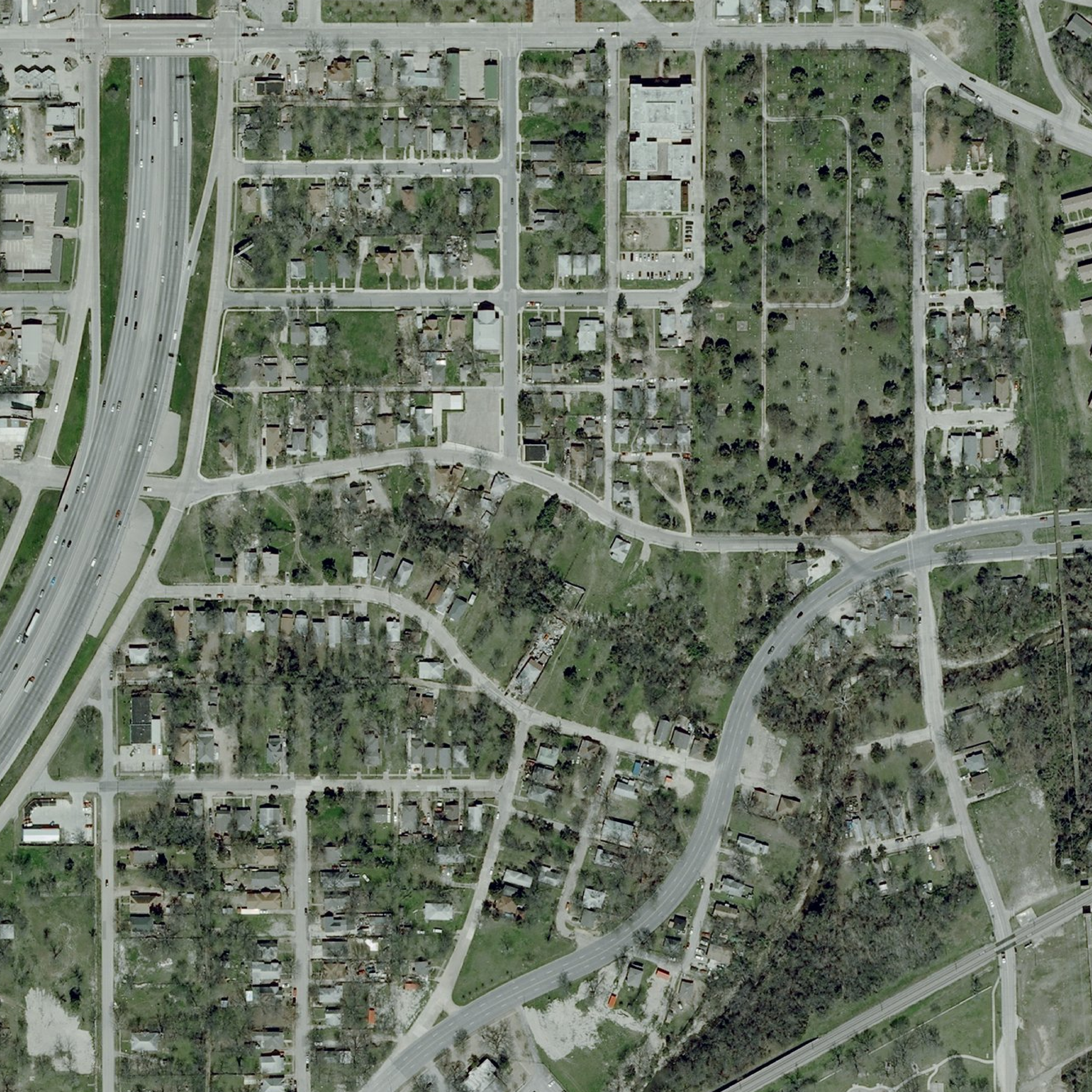
Historic Tenth Street Freedman's Town
Just as Colonial Williamsburg tells the story of American Independence, so might a restored Tenth Street Freedman's Town bring the story of African American Independence to life.
How did the Tenth Street Freedman’s Town come to be, and why does it matter?
Consider assertions made by two reputable sources with a number of years of involvement with the Tenth Street Community. The first assertion comes from Activating Vacancy. Here is how bcWORKSHOP describes their Activating Vacancy initiative:
Activating Vacancy is an art and public interest design initiative in the Tenth Street Historic District of Dallas. Residents alongside artists and designers will investigate, strengthen, and share this community’s unique history; engage in the development of a physical and social framework for cultural activities; and plan for the renewal and growth of the neighborhood. Collaborations including installations, performances, or other artistic actions will explore the cultural, social, political and economic life of this historic neighborhood. The Initiative begins Fall 2013 and is produced and curated by the bcWORKSHOP in partnership with the Dallas CityDesign Studio.
A July 16, 2012, post entitled “NEA Awards bcW Our Town Grant” on the Activating Vacancy microsite at www.bcworkshop.org states:
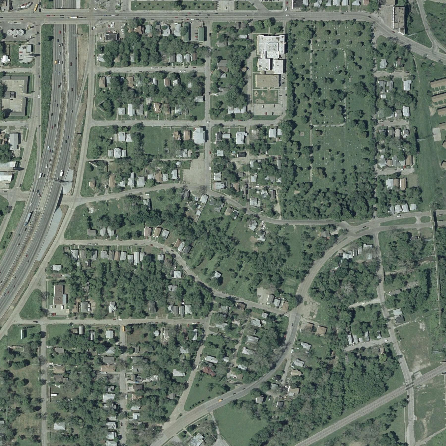
Dating back to the post-Civil War era, the Tenth Street District of Dallas, Texas, is the city’s most intact Freedman’s Town—between 1865 and 1867, a group of former slaves were deeded ten acres of land each.
The second assertion comes from Tenth Street Historic District, A Historic African-American Neighborhood in Dallas, Texas, a booklet prepared by ArchiTexas in 1994 and distributed by the Historic Preservation Section, Department of Planning and Development, City of Dallas. Author Stan Solamillo writes:
The Tenth Street Historic District is part of an area which was initially settled in 1845 by William H. Hord, a Tennessee native and slave holder who later served as Dallas County Judge. This area eventually became known as Hord’s Ridge. Along with all other slaves, the Hord family was notified of their freedom on June 19, 1865, two years after the Emancipation Proclamation was issued. Despite having gained their freedom, the freedmen and women remained at Hord’s Ridge and were deeded 10 acres of land between 1865 and 1867. Together with other former slaves who migrated to the area seeking both employment and community, the freedmen and women settled into what has come to be identified by historians as a “Freedman’s Town”.
Assuming the reliablility of these assertions, a reader of these statements would be justified in concluding that
This account has been repeated so often by people and organizations making decisions for Tenth Street that it is accepted uncritically as true. But is it true? A deed creates a record in the county courthouse. If Hord deeded ten acres of land to each of his former slaves, where are the deeds? No one making these assertions has produced a deed record to document them. If the basis for this account is purely anecdotal, where did the anecdote originate?
Page 42 of Bill Minutaglio and Holly Williams’ The Hidden City, Oak Cliff, Texas references a Hord family memoir assertion that each of the Hord’s former slaves was given ten acres of land in 1875. In his article “Remembering Kidd Springs” (Legacies: A History Journal for Dallas and North Central Texas, Volume 15, Number 01, Spring, 2003), Robert L. Crockett notes that a ten acre parcel of land located just north of Kidd Springs and near the present day intersection of Sylvan Avenue and Colorado Boulevard was deeded to Frank Thomas in 1875. Thomas is believed to have been a descendant of the slave family brought to Oak Cliff by W.H. Hord, but the deed identifies the land specifically as “originally part of the Aaron Overton Survey.”
The ten acres in question north of Kidd Springs, which were home to about thirty African American families, lie well outside of the bounds of Hord’s original 640 acres and approximately two miles distant from the Tenth Street Historic District. No deed record yet brought to light confirms that land from any part of Hord’s original 640 acre survey was deeded to Hord slaves in the vicinity of Tenth Street or anywhere else on the survey. Nevertheless, the assertion that the land beneath the Tenth Street community was a gift to former slaves from kindly former masters is repeated without question and without documentary evidence. Likely, the story of Tenth Street’s genesis related by Solamillo is a conflation of fact and supposition suggested by Frank Thomas’ presumed descent from Hord slaves. No evidence produced so far, however, suggests that Thomas had any connection to Tenth Street, or that any one of the three slaves Hord brought to Texas from Tennessee remained on Hord land to build the Tenth Street community. The account offered by Stan Solamillo and repeated by bcWORKSHOP makes the beginnings of Tenth Street all about W. H. Hord. Hord played a leading role in establishing Hord’s Ridge, the precursor to Oak Cliff, but evidence suggests that the story of Tenth Street is not his story.
Based upon ongoing research initiated in 2008, TenthStreetLife posits that
Why does this matter?
At the time of this writing, Dallas is making decisions that will substantially determine the quality of our economic and cultural life for decades to come. Two initiatives currently in motion, GrowSouth and the Southern Gateway, affect the Tenth Street Historic District directly. Leaders of good will want to make informed decisions that will make the most of this irreplaceable resource and insure the best possible future for Dallas, but without a wealth of accurate information, how can they?
For example, consider these questions:
TenthStreetLife is here to interpret the most accurate and useful information available in the historical record for citizen leaders making decisions affecting the future of the Historic Tenth Street Freedman’s Town.
The Mission of TenthStreetLife is to displace myth and bias concerning Historic Tenth Street with truth, bringing history to life for our city, for our nation, and for the watching world.